Sharing is caring! This quote also applies for GPS data, where a lot of people or businesses share GPS data with their families or customers.
Why would you want to share GPS data? In this post, we’ll go over a few examples on why people share GPS data and how shared GPS data works.
Examples of Sharing GPS Data
Personal Tracking
GPS tracking is not just for businesses! Some private users, especially families, also use and share GPS data with each other.
Here’s a quick story from my childhood. My parents and I had a system where I would call them after I got home from school everyday to reassure them that I didn’t get kidnapped.
It’s a great idea, but if I was parenting, I’d use personal tracking instead. Nowadays, parents can install apps on their kids phones that updates their location and sends a notification whenever they get home or get to school.
Proof of Service
Another example, this time in the business world, is when businesses share GPS data to provide proof of service.
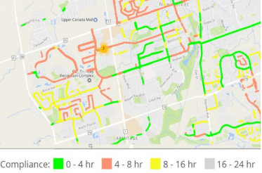
For instance, consider snow plow services. One of their biggest business risks are slip and fall lawsuits. These occur when people fall and claim that the snow plow service didn’t clear the area from safety hazards.
In response, some snow plow businesses started tracking and sharing their service data. As a result of creating a public record, snow plowers protect themselves from false claims.
Customer Service
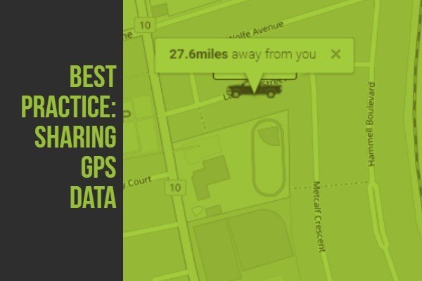
Lastly, some businesses share GPS data to provide better service. For instance, some deliverers share a live status map on their website. Customers can then get live shipping updates by accessing the web portal.
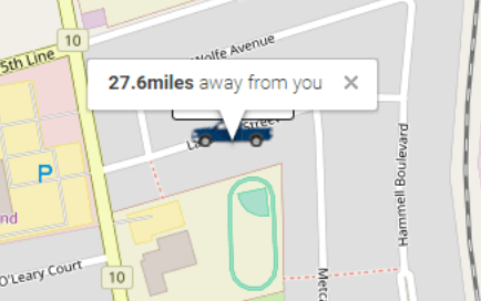
Deliverers found that having the site greatly improves customer service because customers get faster updates and have more reasonable expectations when it comes to shipping delays.
Creating a Map Share
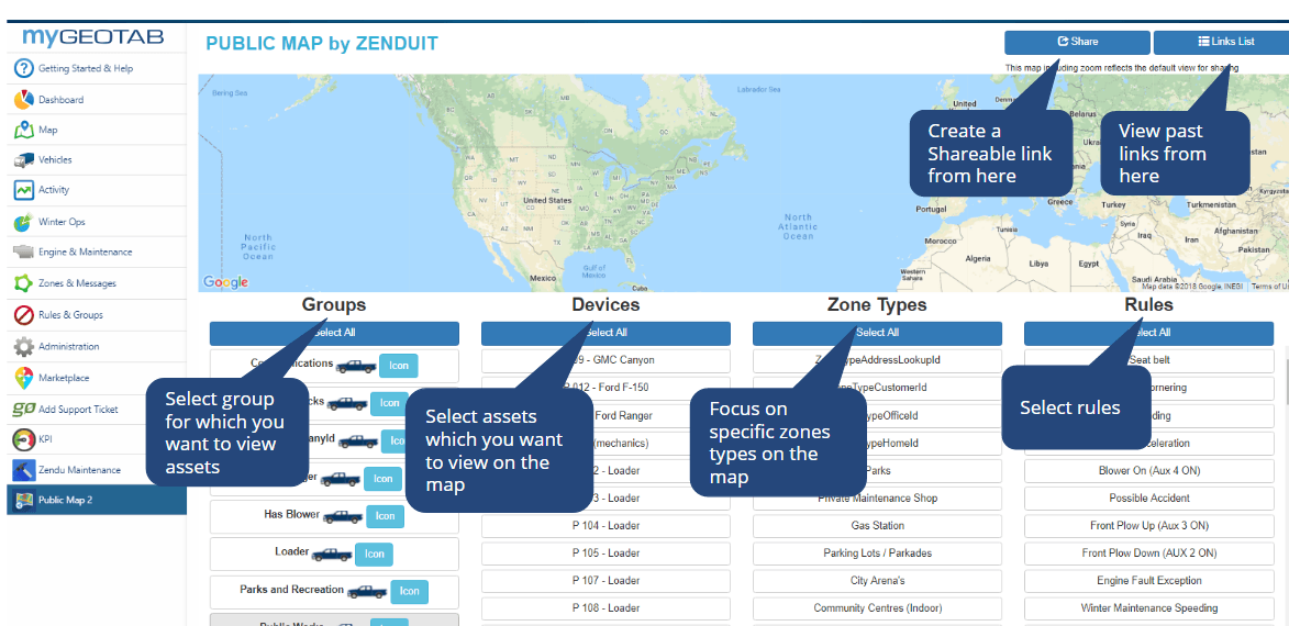
ZenduIT developed a tool called Public Map Share that works with Geotab GPS Data. Public Map Share allows users to create shareable links from map views and filtered rules.
It’s also easy to use. Firstly, users add Public Map Share on their myGeotab account. Secondly, users can select groups, devices, zones and rules on the Public Map Share portal. Finally, Public Map Share generates a link based on selected filters.